Reclaimed Water Process

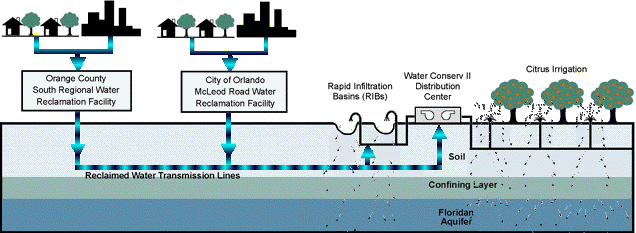
Reclaimed water is pumped from the City’s Conserv II Water Reclamation Facility and the County’s South Water Reclamation Facility to the Water Conserv II Distribution Center in Western Orange County. The water is then distributed to customers for irrigation or to the RIBs through a network of distribution pipes. The entire process is monitored and carefully controlled by state-of-the-art supervisory control and data acquisition (SCADA) computers housed at the Distribution Center.
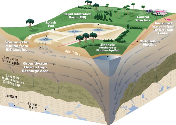
The RIBs are made up of one to five cells, each measuring approximately 350 feet long by 150 feet wide. They are built over a natural sand ridge ranging in thickness from 30 to 200 feet. Beneath these surficial sands is a dense concentration of semi-permeable clays known as the Hawthorn formation.
Operation of the Rapid Infiltration Basin system is accomplished through a computerized management system. The system provides the capability to forecast the impact on the regional groundwater system of loading individual or groups of RIBs at prescribed rates
The Hawthorn acts as a barrier separating shallow groundwater flow within the surficial sands from deeper, confined flow in the Floridan aquifer, which is comprised primarily of fractured limestones and dolomites.
In this region of West Orange and Southeast Lake Counties, shallow groundwater in the surficial sands follows primarily lateral flow patterns above the Hawthorn until reaching areas of low resistance that permit significant vertical flow downward into the Floridan aquifer, thus replenishing our drinking water supply. Initially of sufficient quality to meet most state and federal primary and secondary drinking water standards, the reclaimed water continues to be polished as it travels through the surficial sands and deeper limestones.

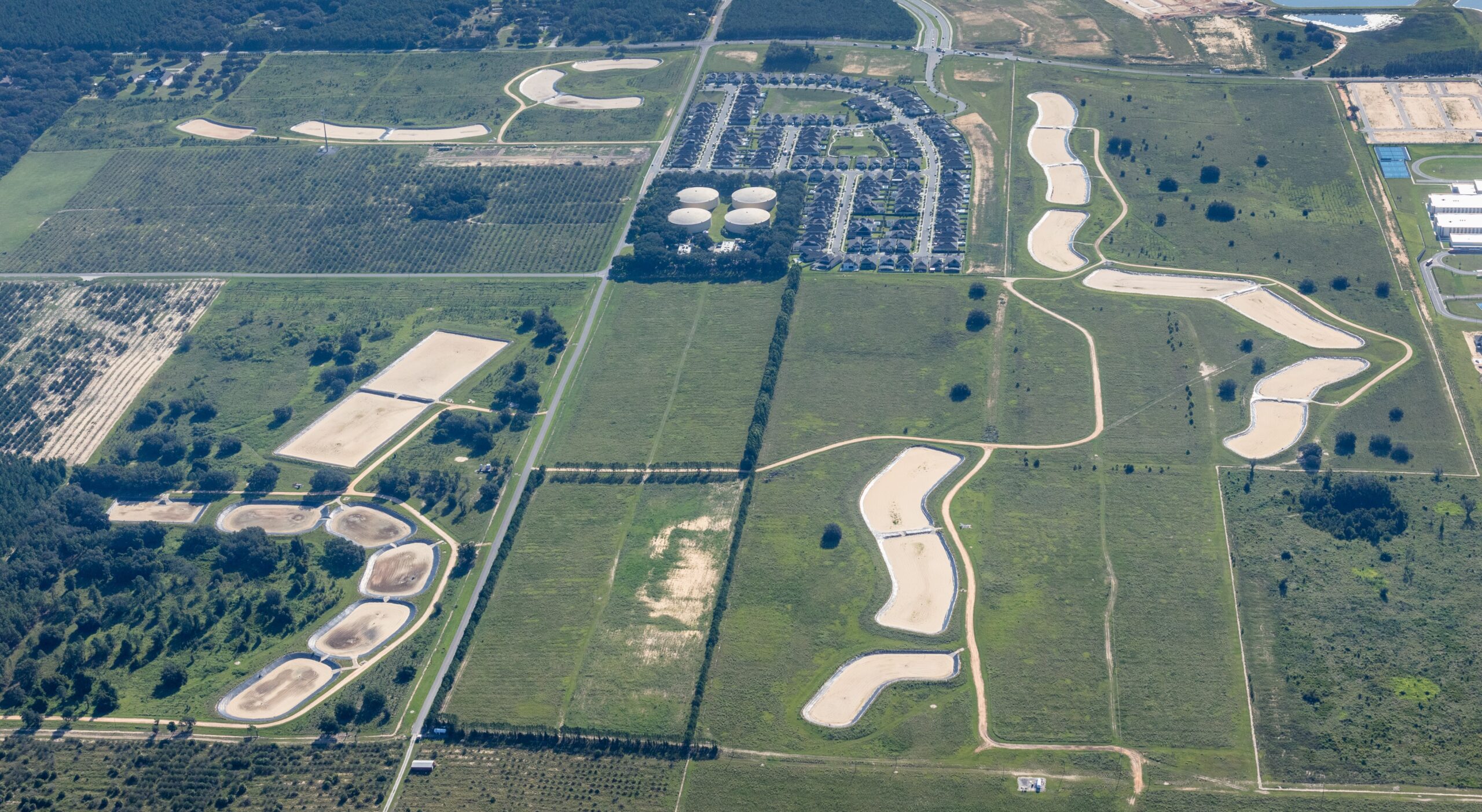
Aerial view of Rapid Infiltration Basin Sites 3, 4 and 5 including the Distribution Center.


